
"Each step forward has a sacred meaning of its own" Sri Chinmoy
Greensand Way Run (17 miles / 2200') - Dec 2023 - Surrey Hills

I had a couple of days in between Work and Christmas Trip which I earmarked for hills, hills and more hills - either on the bike or running. As I had to get to Bookham for Christmas at the end of day 2, I picked a run starting at Surrey's highest point, Leith Hill and a bike ride starting at my ancestral home, Edenbridge. I was up early on the Saturday, dropping Kokila at Heathrow shortly after 6am then feasting on a veggie breakfast at the only place open that early (Bread and Roses in Addlestone). That meant I arrived with my stomach still pretty full at Windy Gap car park around 8am. Sporting a thermal, a gilet, my trail shoes and my new hydration vest (early Christmas present) I set off with 4 hills to bag in around 4 hours.
The first ascent, up to Leith Hill tower, is only around 70m/200' but you cover it in such a short distance that it's quite a tough climb. Although it involved a lot of high stairs I managed to run it, despite the heavy breakfast and no warmup. After three and a bit minutes I was grabbing a photo of the tower and drinking in the views down over the wield, the sun still trying to rise from a bank of cloud over the south downs.

It was after that first, thrilling climb that the wheels came off a bit - I had decided to follow the Greensand Way and naively expected it to be well way-marked. I also had Mapy.CZ as a backup on my phone but for once in my life, no actual map! Waymarks were not much in evidence and where I did find one, it was faded to a blank, white disk, so absolutely no use. So, I took a look at an excuse for a map on a Surrey Hills signboard and tried to find the right trail from among the many routes away from the tower. The one I took began by heading, quite promisingly, due west along the ridge but soon it turned north. Two deer ran across the path in front of me, looking more nervous than graceful as the daylight had begun to brighten and was clearly taking them out of their twilight comfort zone. I followed the trail, which was wide and well signed as a Bridleway but with no waymarks. I guessed when I hit a road crossing, there would be a Greensand Way sign of some kind. When I did hit the road, there was nothing, so I followed it south and after a short while I got enough signal to see that I was way off route. Oh well, if I hadn't got so lost I wouldn't have seen those auspicious roe deer.
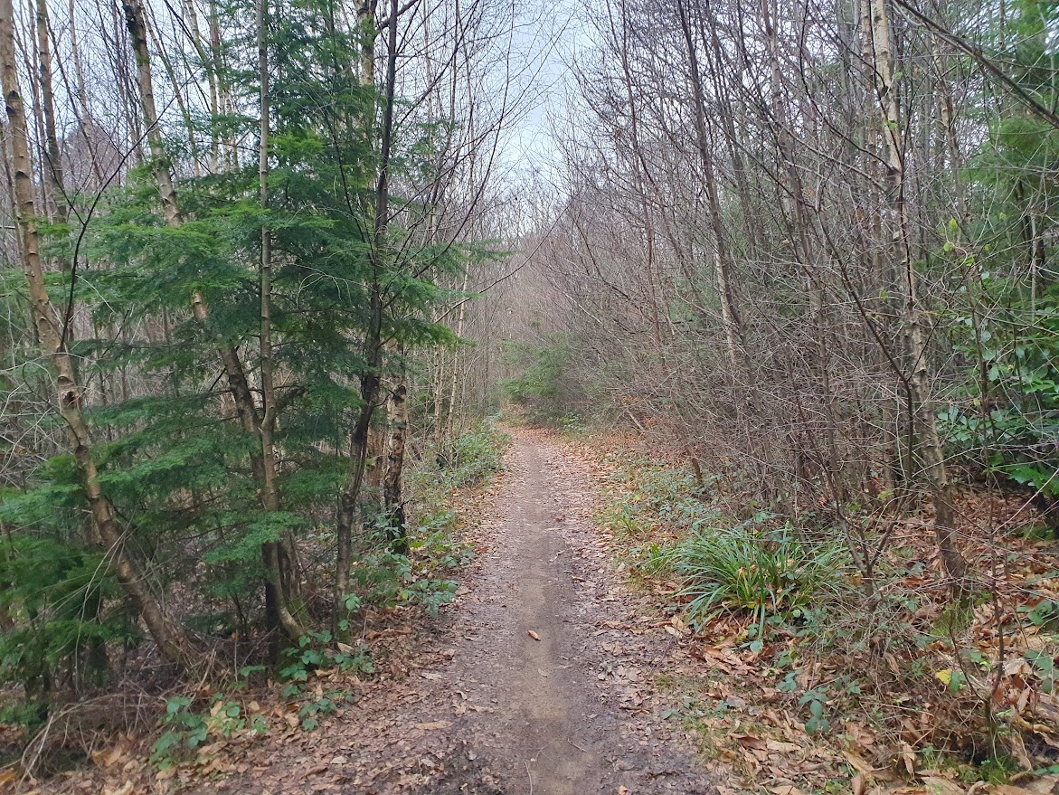
Back on the route I followed a gorgeous path and enjoyed the soft going underfoot. I was making decent pace for a run of that length - I only ever aim for 15 minute pace on serious hills. The wind was blustery but there was no hint of any rain or drizzle so all looked set for a good run, with routefinding and eventual fatigue once I got up over 2 hours as the only worries. The hills and forest were setting my mind free and all was pretty much right with the world.
At the next road crossing, I couldn't see any sign taking me on to a trail on the other side, so I had to explore left and then right looking for the route. Again, no signal (and of course, stupidly, no map!!). I eventually ran through Holmbury and took the biggest bridleway I could see up towards the ridge. It looked set to take me across the line of the path I had been following, which meant there was a good chance I would find the Greensand Way. After a decent climb past the Belmont School, I didn't find the trail but I did find data signal, which showed me I was again way off! I took a few screenshots of the route ahead on Mapy.CZ so at least I would have those as a backup. Then I set it to havigate to Winterfold Hill and set off back down the path into Holmbury and out on a lane the other side. Soon I found the exit from road to trail and began the long drag up to the ridge again. Here I was sharing the trails with mountain bikers, some self-powered but quite a few on E-MTBs, coasting up hills faster than I could run then enjoying the hair-raising descents. I soon worked out which line the bikes would take on the descents and kept out of their way. It was harder on the way up though as I am not used to bikes being that fast on a climb!
After more quintessential surrey trails, leafy and muddy and sandy in turn, I came to a jiggle across a road at Pitland Street and another stiff climb, this one called Somerset Hill, leading eventually to the great ramparts and even greater views of the Holmbury camp. I followed the Greensand Way on a long loop around the fort, coming to the summit to bag my second hill of the day and catch yet more lovely views to the south and also some to the north (where you could just about make out London).

After Holmbury, there came another long section that would have been hard to navigate without the Mapy app, many ups and downs and crossings of fields bringing me to the swanky Duke of Kent School and the stiff climb to Pitch Hill.

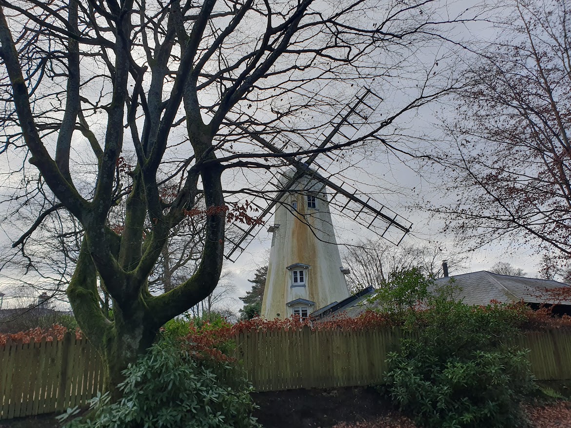
With the clouds thinning out a little I could pick out the ridge of the South Downs clearly now. Many mountain bikes were sharing the sandy trails, even more than on Holmbury. The final ascent up to Winterfold Hill begain with the pull up to Ewhurst Windmill, which seems to be a private house (I lifted my phone above the level of the high fence to grab a photo, as you don't see many windmills round these parts) before another descent took me to a crossing of the Pitch Hill road (a cyclist's nemesys at over 20%) then via many undulating paths and sections of lane to the rather ill-defined summit of Winterfold. There was nothing to show the highest point but when I felt I was there I took a selfie, had some energy gel and headed back. There were around 2.5 hours on the clock and I felt fine.

On the way back I made much better time. No routefinding mistakes this time, with the signs more evident from this direction and the app locked on to Leith Hill tower as my endpoint. I was happy to find myself chugging steadily along at my target pace even after three hours and approaching four. I ticked off the summits in reverse, stopped for a coffee and brownie at Heartwork Coffee in Holmbury (slap bang on the lane section of the Greensand Way so no detour required) then made a caffeinated assault on the final ascent to the tower. At the end I had done a shade under 17 miles in 4 hours 15 so that was on target even with the coffee break and a lot of faffing. It did feel as if I was getting into shape. After the run I was hoping to drop into Vaughan-Williams' house at Leith Hill Place but a National Trust poster told me it was closed for refurb. So, I tried Knole Park instead and that was ticket only. Third time lucky I got to Ightam Mote where I was able to wander round the ancient, moated manor and polish off a post-run cream tea. I decided to give it a few days to see how the body reacted and if all was well, sign myself up for a trail ultra (a modest 50k on Dartmoor or Exmoor) - assuming those are not sold out. As usual I was getting ahead of myself, as I had a 106k / 1.75AAA Audax Perm booked in for the very next day, at Edenbridge.
Sacred Steps Home
|